Audiovisual History of the falaise Saint-Jacques
This project is a year in the making. It is a collection of oral testimonies and stories from community members and figures who were involved in or related to the history of falaise. Students and seniors collaborated to weave the narrative of this forest together, from its existence as a dump site to the creation of the park we know and love today. We are showcasing our video as well as a walk-through timeline.
Timeline of the falaise
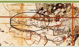
1702
SOURCE: Description générale de l’isle de Montréal divisée par coste (detail), 1702.
Bibliothèque de la Compagnie de Saint-Sulpice, from Atlas historique de Montréal, p. 43.
1733
1851
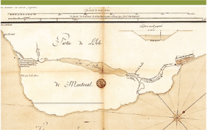
The Lachine Canal was built to create a safe way around the Lachine rapids. Before this, the falaise was used as a portage route around the rapids. There is circumstantial evidence that the village of Hochelaga, boasting 2000 inhabitants, was on the west side of the falaise, and scholarly articles have been written about it.
SOURCE: Projet du canal entreprise par les sulpiciens pour contourner les rapides de Lachine.
Gaspard-Joseph Chaussegros de Léry, 1733. Centre des Archives d’Outre-Mer, Aix-en-Provence tiré de Atlas historique de Montréal, p. 677.
1913
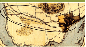
The falaise is so steep because it was the side of Lac à la Loutre, also called Lac St-Pierre. After the last ice age, the Champlain Sea stretched from the bottom of Montreal Island to Quebec City. Over time, as the ice melted and the land rebounded, the seawater drained away. By the 1700s, the Champlain Sea had been reduced to the size of a lake, Lac St Pierre or Lac à la Loutre. In the 1850s, when the Lachine Canal was built, the lake lost much of its remaining water and became a swamp. By the 1960s, so little water was left that the city decided to put a train yard there, the Turcot Yards. Notice the falaise within the circle, the marks of swampland below it, and the Lachine Canal cutting through the swampland.
SOURCE: Environs of Montreal, (détail), George Horatio Smith, 1851.
Tiré de Atlas historique de Montréal, p. 99
.
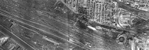
1949
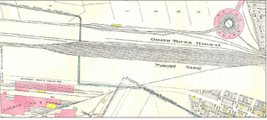
The area was now a swamp, so the powers decided this would be a perfect place to put super heavy trains. There are stories about two train engines sinking into the muck and never being seen again!
SOURCE: Turcot yards – Photo La cour de triage Turcot. Photos aériennes, 1949.
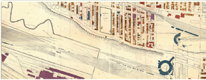
1949
The exciting feature of this map is the St. Pierre river running from the west. The falaise used to stretch from Pointe à Callière to what is now Pointe-Claire. Currently it is divided up by train lines and highways. The 20, which runs underneath the falaise, separated the NDG part of the falaise from the Lachine/Côte-St-Luc parts. The last remaining part of the St. Pierre River, which ran across Meadowbrook Park, was covered over last year despite much protest.
SOURCE: Ville de Montréal, (détail), 1949, planche 44-68. Ville de Montréal
.
1950s
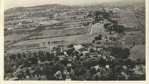
Notice that NDG is mostly farmland at the time.
SOURCE: Elmhurst 1950’s
1966
2003
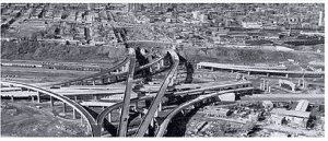
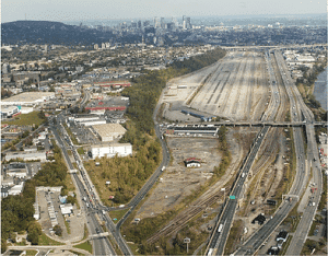
When the Décarie expressway was built, the rubble left over from construction was dumped on the falaise. It is thought that there are 100 metres of fill in some places. The Turcot, built to serve West islanders and not the people in the vicinity, destroyed the continuity and gave rise to some of the poorest sections of Montreal: Ville St Pierre, Westhaven, St Raymond, St Henri, and Fielding Walkley.
SOURCE: L’échangeur Turcot en construction en octobre 1966. Ville de Montréal.
2004
Falaise before Turcot reconstructing
SOURCE: L’échangeur Turcot en construction en octobre 1966. Ville de Montréal.
2015
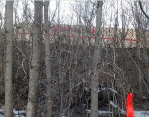
In the early spring of 2015, Lisa Mintz was walking home to Montreal West through the falaise when she noticed that a surveyor had been in and had marked off a huge section of the falaise. She called Peter McQueen, who told her to come to the “bon voisinage meeting” that would be held the next evening. She went, and asked, showing pictures, what was going on. She was told that the orange markers denoted a line, and when the construction workers found any of the endangered brown snakes, they would put them back behind that line so they would be safe.
2015
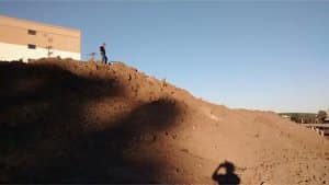
After Incursion of Turcot 2015 – When Lisa returned from a trip in October, she saw that the entire hillside had been razed. She got mad and started Sauvons la falaise!
2018
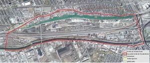
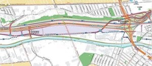
Map of falaise with Dalle-Parc, 2018
2019
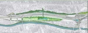
Falaise becomes a grand parc,
2022
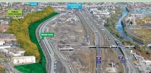
Bande verte consultations
The falaise is in light green, and the bande verte is in dark green. The bande verte is a strip along the bottom of the falaise, an average of 30 meters all along its length, adding up to nine hectares. The Ministry of Transport (MTQ) was forced to do this to make up for the 2 hectares lost at the far west side (by the Uhaul). On this map, that area is already bare of trees (see left corner bottom of the map). The bande verte was installed by the MTQ and was opened in a public ceremony by Sauvons la Falaise! and CRE Montréal in September 2022.
